Title Page | Map1 | Map2 | Map3 | Map4 | Map5 | Map6 | Map7 | Map8 | Map9 | Back to my assignments page
|
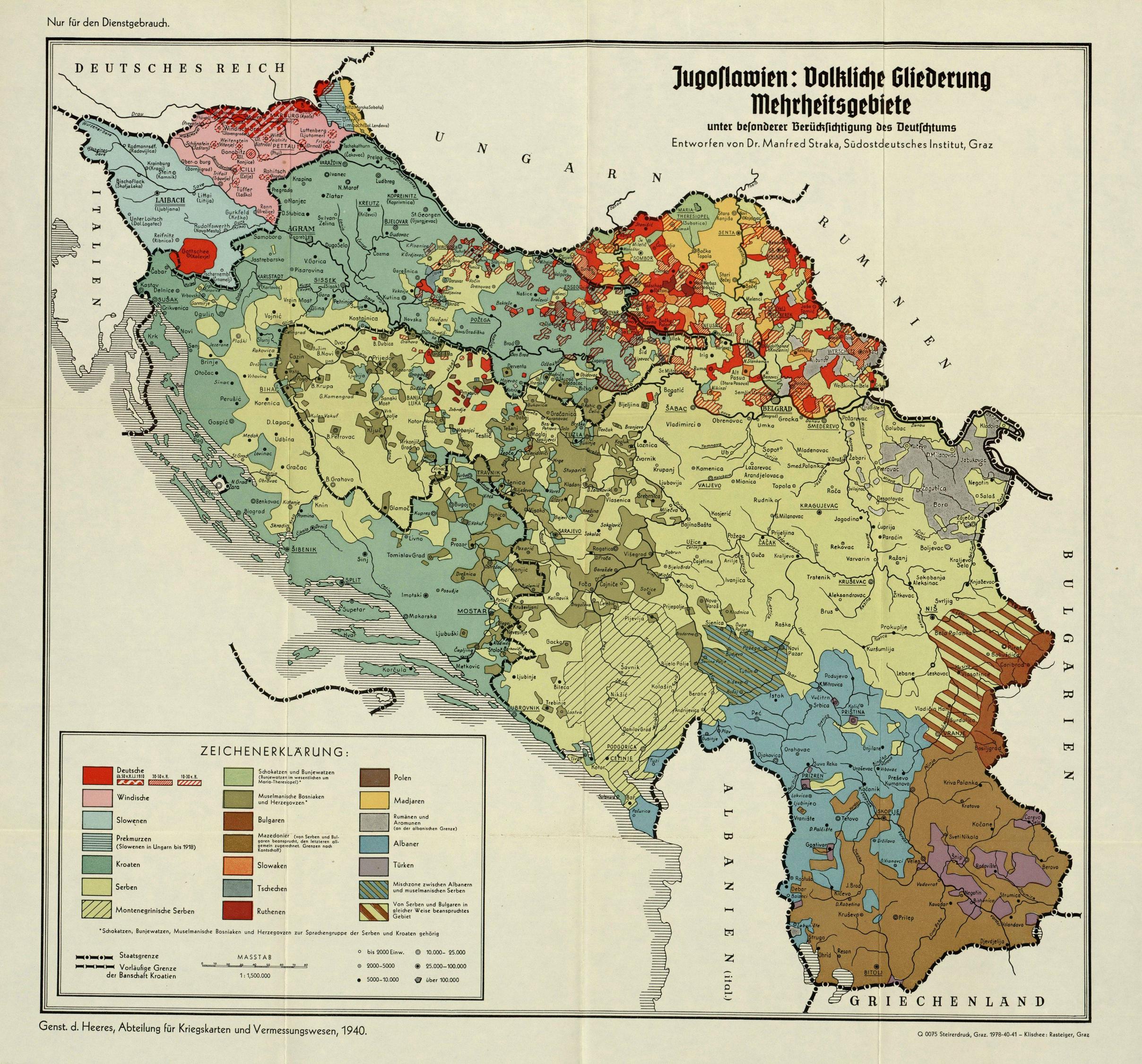
After the collapse of Austria-Hungary, the slavic peoples occupying the western Balkan lands fulfilled their desire to become a sovereign nation state through the Kingdom of Serbs, Croats, and Slovenes -- Yugoslavia. The extended european debate over lands and nation states was not finished, however, and the Axis powers invaded Yugoslavia during World War II. The Nazi agenda had long identified Jews, Slavs, and Gypsies as sub-races and a particular threat to racial purity, and these populations were targeted by the Einsatzgruppen (Nazi death squads) as they swept through eastern europe. Germany, like France, Great Britain, and other countries with established academic traditions, had been a center of mapmaking prior to this period. Still, it is interesting to view a map of "national division majorities with special consideration of Germanism" in this context. Accordingly, this map is valuable for its identification of the long-standing buffer zone between Slavic and Germanic peoples in Europe (the Germania Slavica). The map identifies the Windisch (pink), a German term for Slovenian-speaking peoples as well as the Slovenians (light blue). The Prekmurzen, Slovenians in Hungary, are also identified (striped blue). The once vibrant Jewish communities of the Balkans are no longer visible in ethnographic distributions. |